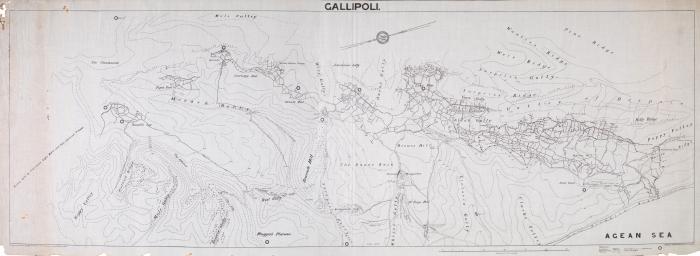
This map of Gallipoli shows the sector held by the Australia Light Horse and New Zealand troops. It was originally drawn by A.H. Bardin in 1915 and then traced by F Redfearn between 1921 and 1923. It shows the various allied trenches, tracks, dugouts, and cemeteries, it shows the Turkish trench lines and uses the allied vernacular for all the place names on the map.
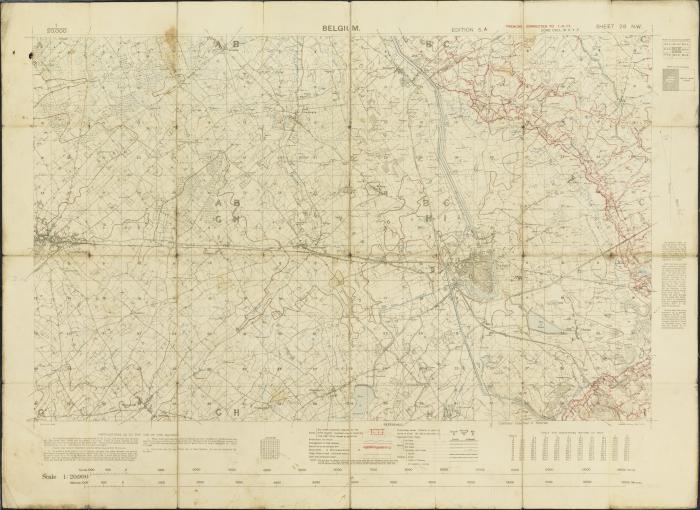
The front lines often moved as a result of offensives from one side or the other. This meant the trench maps had to be regularly updated. The map in the State Library makes fascinating viewing, is highly detailed, and was current on 1 April 1917. Interestingly, Hill 60 is visible on this map (can you find it?)
By June 1917 the 1st Australian Tunnelling Company had completed the undermining of Hill 60 after which the mine was filled with 53,000 pounds of explosives. At the opening of the Battle of Messines on 7 June 1917 the explosives were detonated turning Hill 60 into a crater 18 metres deep and 79 metres wide. For more digitised trench maps, please see the National Library of Scotland’s online collection of British trench maps.
Topic