Maps

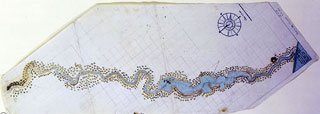
Swan River Map 1801
Some maps may be of use to the genealogist. Various series of land ownership maps have been published by the Lands and Surveys Department (now Landgate). The chain series is a series of maps in different scales - 20, 40, 80, 240, 300 and 800 chain. It is available in several editions and shows the changing patterns of land ownership from 1900 to the 1960's. The whole state is covered and an index map exists. Other archival map series relating to land are held at the State Records Office.
An earlier series of maps (ex 298C, now 45/9-16) was commenced by the Lands and Surveys Department in about 1880 with an S and C series for the Southern and Central areas on an 80 chain scale. This was followed by an M, G and K series for the Murchison, Gascoyne and Kimberley districts respectively on a 300 chain scale. There is also a miscellaneous L series and an index map for the series which covers most of the state. The S, C, G & K, M and L series are now all available online.
The cancelled public plans of the Lands and Surveys Department (see CN 77 for listing) also provide information on the opening up of land in certain districts and localities.
These map series may provide names of people owning or leasing land, acreage, location or lease numbers, and dates. Other maps may be useful for tracing landowners, eg real estate plans (78C on aperture cards, see CN 1 for listing; 101C-103C on aperture cards, see CN 3 for listing), Post Office Directory maps, and the townsite map series (ex 211C) which will give background information on land and often valuable dates for settlement. The townsite map series has been individually catalogued, so to locate a plan of a particular town, simply enter the name of the town and the word townsite in the keyword option of a map search. Map reference numbers can be located in the online catalogue.
